
TABLE OF CONTENTS:
|
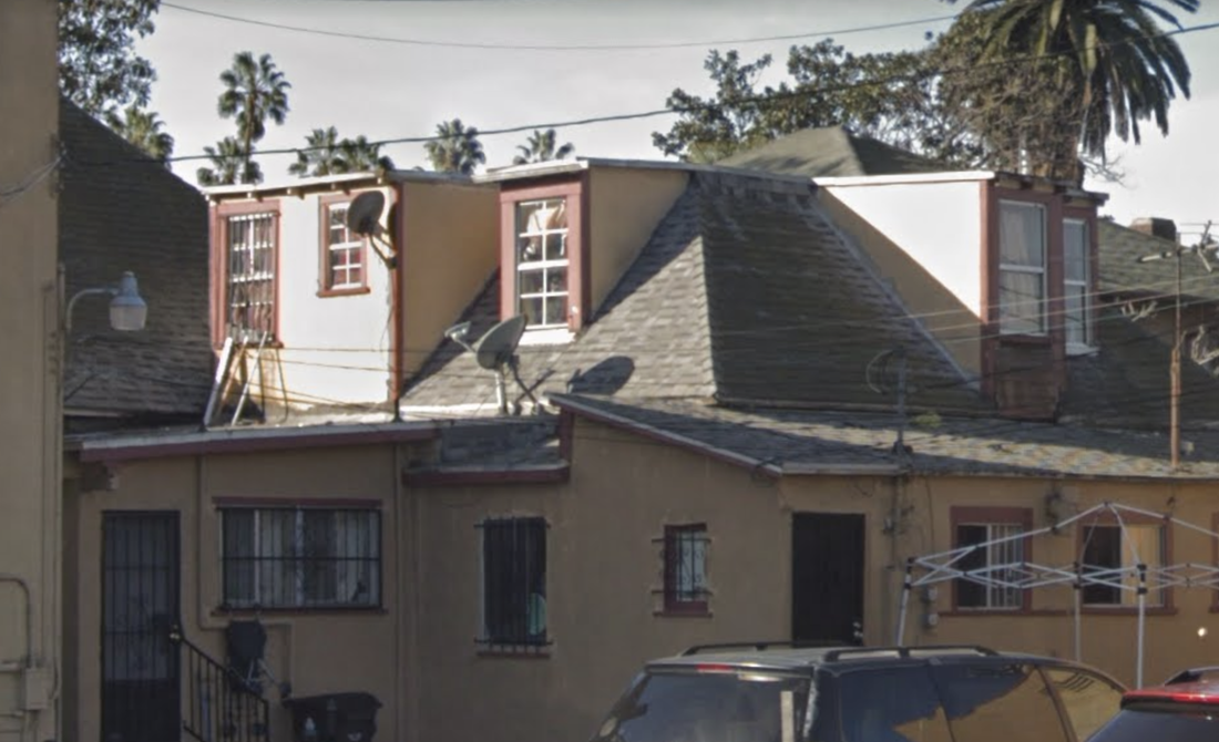
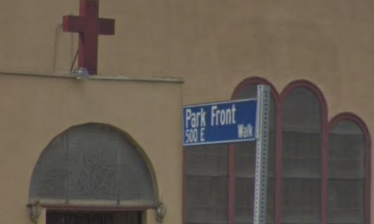
Looking for South Park? You're on the Wrong Side of the 110. 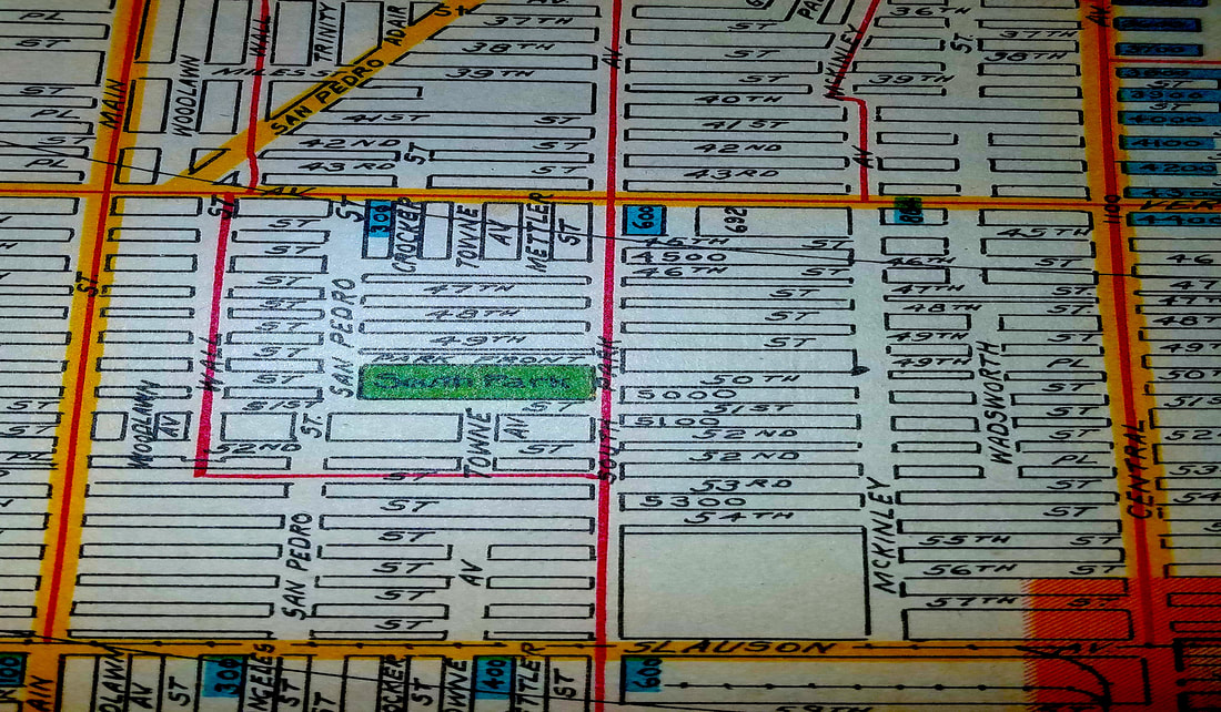 No, I’m not talking about where Stan, Kyle, Kenny, and Cartman live. In the past decade or so, the vicinity around the west and south sides of the L.A. Live has been publicized as “South Park,” and the area’s eponymous business improvement district has further perpetuated this rebranding. The “South Park” I’m talking about is not where the Staples Center is, either. It’s on the other side of the 110. --- At Avalon Boulevard and 49th Street, there is a beautiful recreational area called South Park. The recreational area is part of a larger tract of the same name. Bisecting the tract on its north sides is a little walk street called “Park Front Walk. ” Most of the homes on this street are two stories, average 2,000 square feet, and are built in the Craftsman, Tudor, or Transitional styles. The grandeur of the Park Front Walk homes contrasts with the general vicinity of Slauson Avenue, which contains mostly low-rise residences, commercial fronts, and light manufacturing buildings. 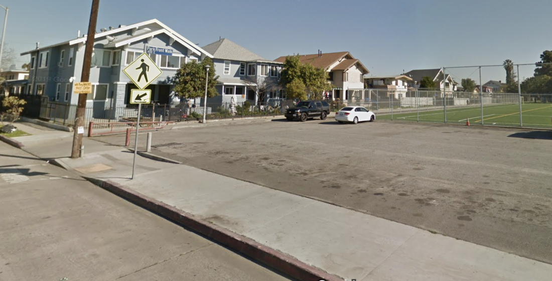 So, why are these houses on Park Front Walk so much bigger than most others in the Central-Alameda neighborhood, and how did this South Park tract get its name? The recreational area and neighborhood known as “South Park” dates from a time—prior to the late 1910s—when Avalon Boulevard south of Downtown was called “South Park Avenue.” The tract itself was subdivided in the early 1900s by a one J.T. Burton as the PARK FRONT TRACT. During the early periods of development, this walk street was referred to by its now-historic name: “South Park Walk.” 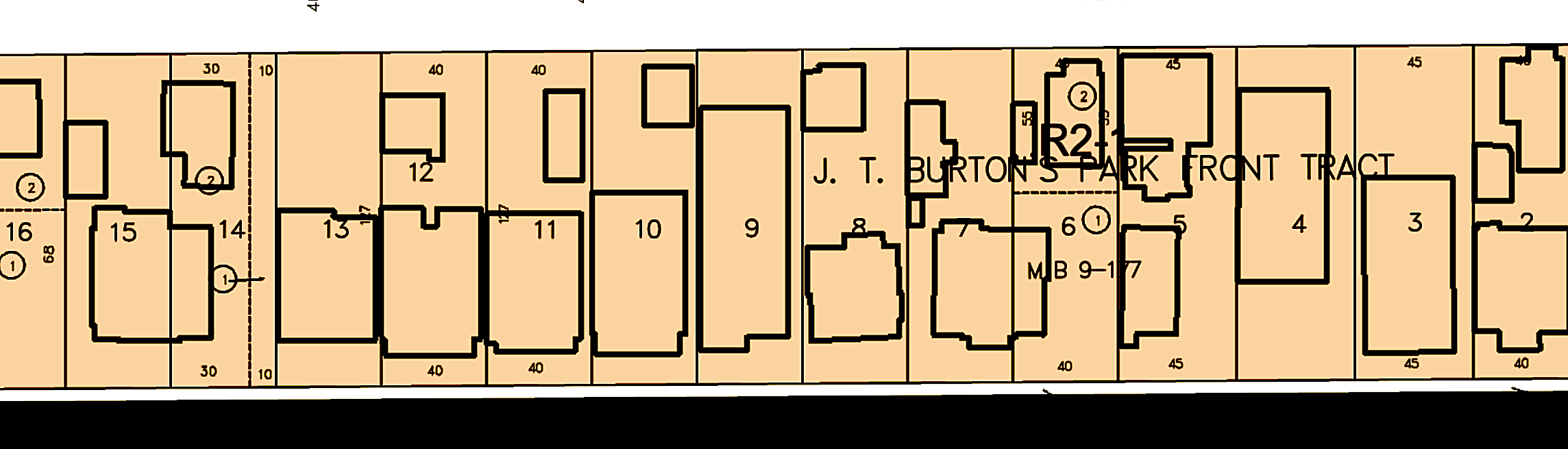 The homes on the walk street bear 49th Street and Park Front Walk address numbers, and nearly all were built around the same period: 1907 to 1912, with small infill developments occurring in 1922 and 2003. The northeastern corner of the walk features a small Mission church from 1927; the owner of the church built the hut next to it in 1895--the oldest house in the park.
Today, Park Front Walk is one of the many extant reminders of a different era in South Central. Until December 26th, 1906, Slauson Avenue was the Southern Boundary of the City; this Southern boundary was originally 25th Street until April 12th, 1896. Basically, in the early 20th Century, South Park was considered a “suburb” of Los Angeles, as were neighborhoods like Highland Park. Until the early 1930s, the area south of Slauson was largely agricultural, and the nearest settlement, two miles down the road (i.e. at Normandie Avenue), was referred to by the name of the trolley station: Wildasin. Folks in these southern wards of Los Angeles came from all over the world, in search of a more peaceful setting outside the hustle and bustle of Downtown. A lot of the Park Front Walk homes have been listed on Zillow and Redfin lately…I hope they don’t fall to development.
0 Comments
Leave a Reply. |
AuthorWrite something about yourself. No need to be fancy, just an overview. Archives
June 2020
Categories |
 RSS Feed
