
TABLE OF CONTENTS :
THE EAST SIDE OF SOUTH CENTRAL (aka Historic South Central): A Brief History and Architectural Tour.6/30/2019 THE EAST SIDE OF SOUTH CENTRAL (aka Historic South Central) A Brief History and Architectural Tour by Damian Gatto
With its diverse socio-cultural history, architectural gems, and closely-knit communities, the East Side of South Central is one of Los Angeles’s oldest residential districts and one of its first suburbs. The district is bound roughly by Washington Boulevard (N), the City of Vernon (E), Main Street (W) and Slauson Avenue (S). Central Avenue, the district’s namesake, runs prominently throughout South Central and all the way to Del Amo Boulevard in the City of Carson. Much of the future neighborhood was included in the City of Los Angeles' original 1781 imperial land grant, but it remained largely agricultural until the mid-late 19th century. Even then, residential development in the East Side of South Central predates the West Side of South Central by over three decades, commencing in earnest around the 1870s. The community's antiquity reflects in the historic architecture that appears throughout the district. 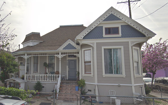 (Above: Some early residents of South Central, expatriates from Bunker Hill, sure brought their architectural sensibilities with them. This is a beautifully restored Queen Anne Victorian on 32nd and Maple, with Second Empire influences.) (Source: the author.)
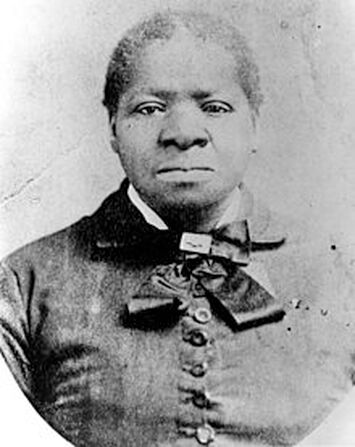
I. Early History and Biddy Mason This community, like relatively few other districts of Los Angeles of the time, contained a fascinating mix of people across race and class. The earliest residents included fire fighters and police officers, such as Officer Cecil S. Bowman, who resided at 1000 East 32nd Street and died in the line of duty on June 8th, 1911. Many early immigrant entrepreneurs purchased homes in the Central Avenue District, as it was first known. Peter Mayer, who was born in Colorado and ran one of the nation’s largest leather suppliers with his father, P. Mayer Leather Works, retired to Los Angeles in his old age, living on East 34th Street. Others commuted to Downtown on the Red Car trolley to work in factories or to help build the railroad. Still others were day workers who built homes for the more privileged, as my genealogies on Chavez Ravine, the Naud Junction neighborhood, and the Macy Street neighborhood have revealed. Even further still, early residents included Anglo residents who had originally lived in Bunker Hill, but in their old age had decided to retreat to early suburbs south of Downtown, such as South Park. However, the residents who would come to define the area's cultural history were descendants of freed African-Americans and their families. They initially moved into an enclave near Spring Street known as the "Brick Block" and congregated around the landholdings of a woman named Biddy Mason. A tremendously successful and charitable woman in her own right, Biddy Mason donated considerable sums of her living to charity, sheltered the poor, and risked her life to help fight smallpox, which took the life of her young daughter. For this, Biddy Mason is one of the most important pioneers of early Los Angeles. The early African-American community in Los Angeles history was thus solidified with this congregation around Mason’s landholdings, along with Mason’s founding of the First AME Church, which is still in existence. However, many also sought to escape the ill habits of certain downtown neighborhoods, particularly those east of Main Street, which had become home to flop houses and red light districts. As such, they moved directly south along the Central Avenue Corridor and started anew in this suburban neighborhood, the Central Avenue District. By the 1910s, the California Eagle was calling the Central Avenue District the “Black Belt” of Los Angeles. Immigrants from all over the world also arrived in South Central, chiefly from Japan and Italy. Now transitioning out of its days as a mostly-White suburb, the Central Avenue district became attractive to working-class immigrants because it proximity to (and yet isolation from) Downtown’s business districts, as well as its being served by the streetcar. Even more African-American residents arrived in the neighborhood in the early 1940s due to the promise of wartime manufacturing jobs and the decline of other cities and towns across the country. By now, the Central Avenue District, which had been redlined in the 1939 HOLC surveys, had become a decidedly low-income area of the city. Nevertheless, the neighborhood continued to prosper as a center of working-class creativity and entrepreneurialism for generations. With, first, the abolition of racially-restrictive housing covenants in 1947, and then with integration policy in the late 1960s, African-Americans moved into the West Side of South Central, as well as other districts around Los Angeles like Mid-City and Baldwin Hills. Beginning in the 1980s, Latinos began settling in the East Side of South Central in large numbers. It was a first-stop for many first-generation immigrants. Others relocated in an attempt to escape the violence of districts like MacArthur Park and Boyle Heights--only to find themselves in one of the most violent LAPD divisions, Newton Division. Shootin' Newton. In 1988, the neighborhood had more completed applications for immigration amnesty than any other in the nation. While South Central and Southeast LA County cities like Compton had once been the focal point of the nation's largest Black community, between the 1970 and 1990 Censuses, the black population of South Central declined by 32%. By the 2000 Census, the East Side of South Central (by then coined “Historic South Central”) was one of the top 20 Latino-predominant statistical areas in Los Angeles County. As of the 2010 Census, there are 19,474 people per square mile, one of the highest densities in both the City and the County. A quarter of households are headed by single mothers, also high for the City and County. The population is quite youthful; the average age is 23, and nearly half are under the age of 35. (Below: An 1899 vernacular cottage with containing the shell of what used to be a stable.) (Source: Google Street View) 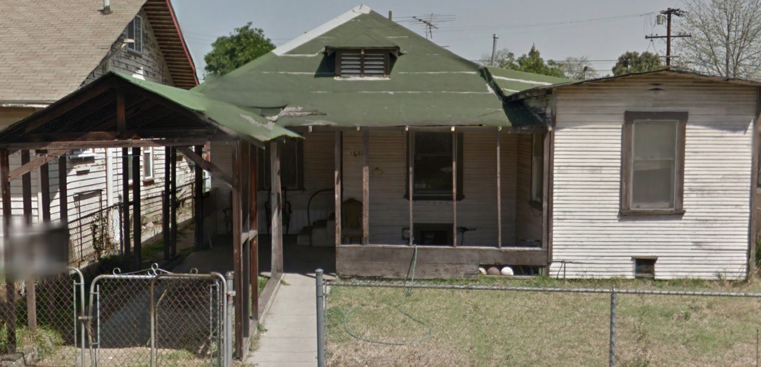 Today, the East Side of South Central remains a humble, working class community on Los Angeles' border with the industrial city of Vernon. The neighborhood’s historic, low-rise nature is reminiscent of how much of Los Angeles looked until the early-mid 20th century. Some residential blocks closer to Long Beach Boulevard and Alameda Street exhibit an obvious transition into industrial land use, depicted below. (Source: Google Street View) 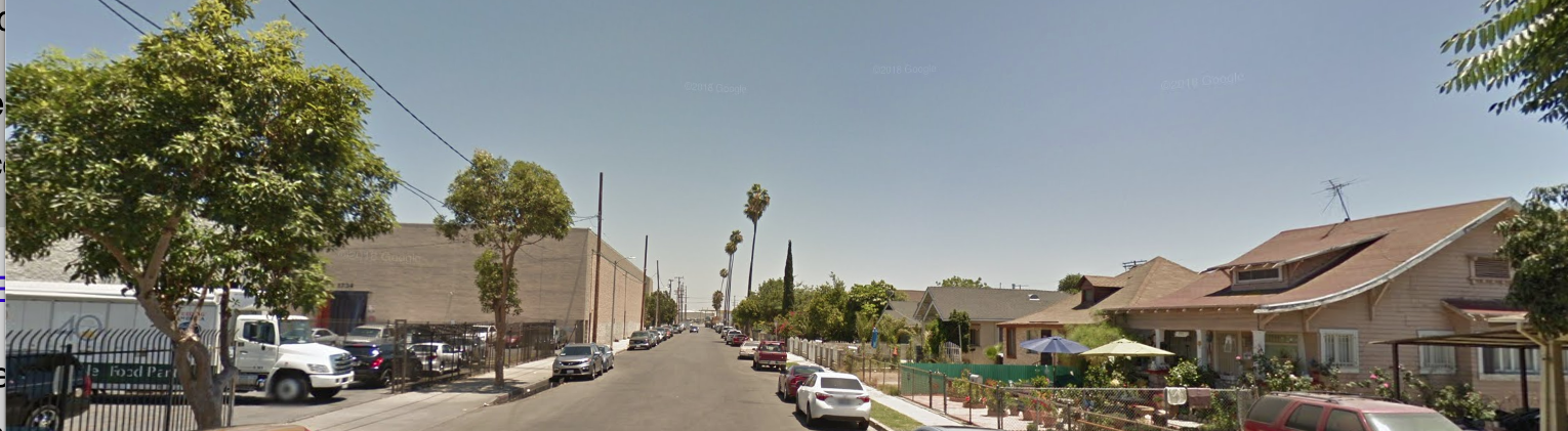 I got to know the community through a South Central heavy metal band I used to perform with, called Sector. The drummer lived on 43rd Street near Compton Avenue. The community reminds me a lot of where I grew up in Northeast LA. Homies work on their cars together. Little kids frolic in their front yards until sundown and then some. Street vendors stroll the block. Dozens of small family iglesias all project their versions of the gospel upon the street scene outside. The East Side of South Central has even retained different monikers for its different sub-sections. The northern part of the district is known as the "Low Bottoms," because of the smaller numbered streets that run through the area (e.g. 20th Street and 31st Street), while the southern portion along Long Beach Avenue is called "the Pueblos" after the Pueblo del Rio Housing Projects. The Central Avenue District.....South Central.....Historic South Central......the Low-Bottoms.......the Pueblos.....I love each of these names, as they illustrate the neighborhood from a variety of historical and socio-cultural standpoints. II. Residential Development Settlement and residential development in the East Side of South Central predates that of the West Side (e.g. Jefferson Park, Arlington Heights) by several decades—on some tracts, up to 40 years. This, in effect, makes the East Side of South Central the original South Central. There are some stunning examples of architecture in the East Side of South Central. Many specimens transcend the facadism of many tract homes around the City. It is astonishing more of the East Side of South Central does not have a historic protection overlay zone, aside from the recently-proposed 28th Street HPOZ. Granted, I’m not suggesting a sweeping HPOZ spanning the entirety of the neighborhood (since it is not the function of historic preservation to prevent any and all development. The fact is, there are plenty of architectural gems in the East Side of South Central that can and should be documented before development takes out many more of them. Let's check out some examples of residential and commercial architecture in the East Side of South Central. CLICK "READ MORE" BELOW
2 Comments
|
Archives
December 2022
Categories
All
|
 RSS Feed
